Most of the 5,000 acres of growth was on the west and east sides
By Bill Gabbert |Wildfire Today
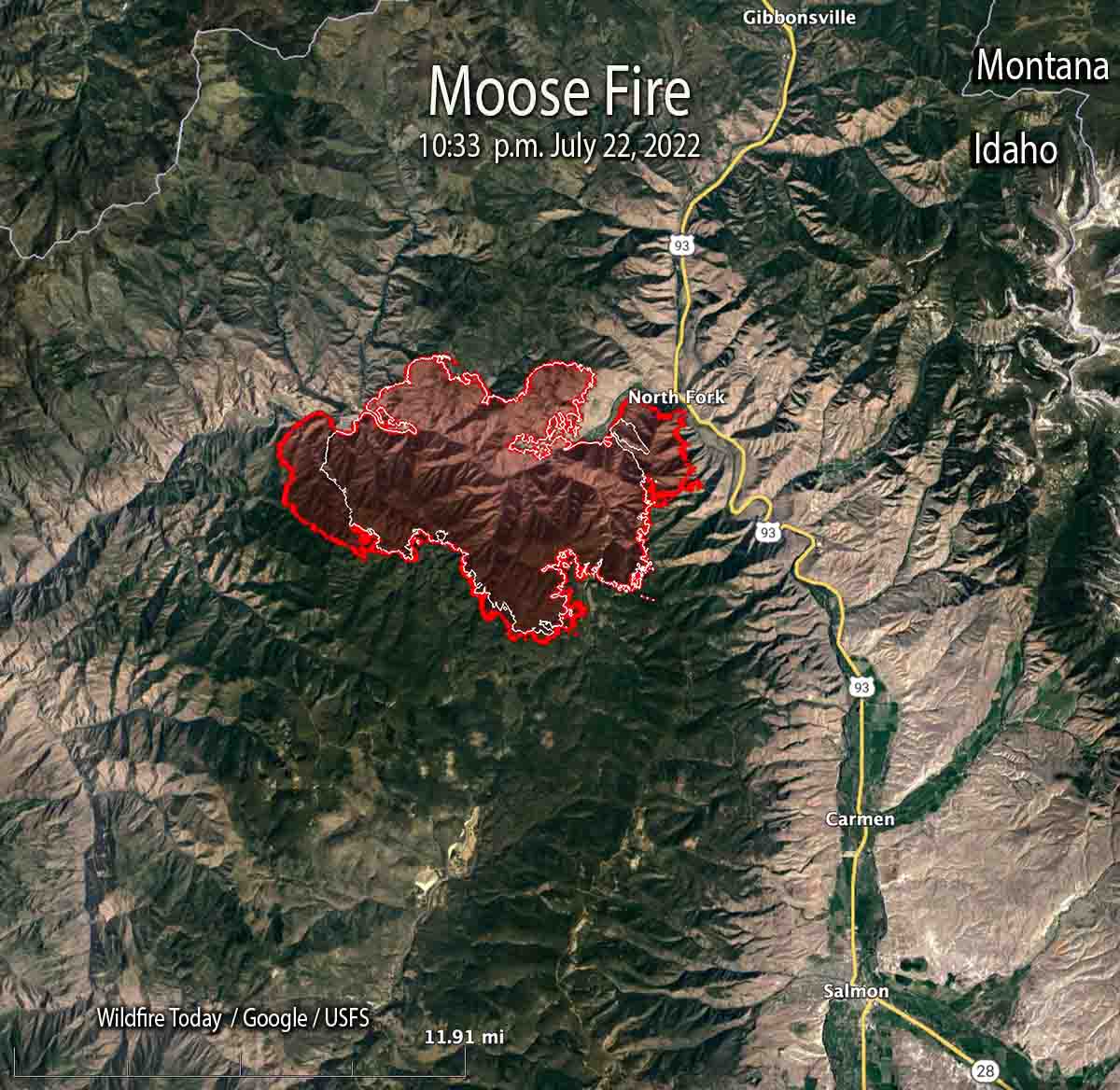
Most of the 5,000 acres of growth of the Moose Fire in eastern Idaho Friday was on the west and east sides, spreading for about a mile to the east and west. Friday night the fire burned actively, spreading west as far as Kayak Camp. In the North Fork area it reached the west bank of the Salmon River. Two miles of the east flank are on the steep slopes west of and above US Highway 93.
Friday’s Red Flag weather conditions increased fire activity along the top of Napoleon Ridge. North of the Salmon River, firefighters succeeded in holding the fireline built during the last several days.
Related wildfire news:
Thousands ordered to evacuate as wildfire near Yosemite National Park explodes
At 10:33 p.m. Friday it was mapped at 28,839 acres. At that time it was 12 miles northwest of Salmon, Idaho, and 10 miles west of the Idaho/Montana border.
Two pilots were killed Thursday, July 21 when their Chinook helicopter crashed into the Salmon River while working on the fire. They were identified as Thomas Hayes, 41, of Post Falls, Idaho, and Jared Bird, 36, of Anchorage, Alaska. The National Transportation Safety Board will conduct an investigation.
If you liked this post you’ll love our daily environmental newsletter, EnviroPolitics. It’s packed with the latest news, commentary, and legislative updates from New Jersey, Pennsylvania, New York, Delaware…and beyond. Don’t take our word for it, try it free for an entire month. No obligation.