Reuters / Richard Carson
Eric Holthaus reports for Grist:
The pictures are heartbreaking, the statistics are mind-boggling. And, incredibly, it’s still getting worse.
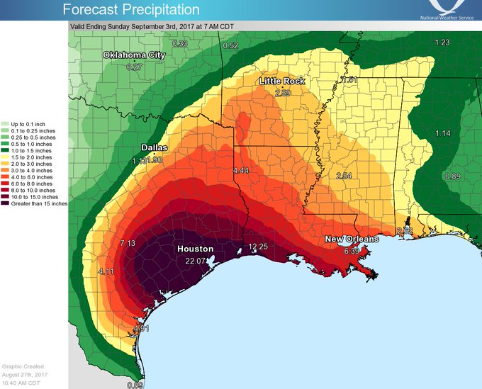
Since Hurricane Harvey made landfall in Texas late Friday night, more than 40 inches of rain have fallen in parts of the Houston metro area, producing the worst flood in the city’s modern history. The latest forecasts show another 15-25 inches on the way before Harvey clears out of the area on Wednesday. Harvey is sure to rank as the worst rainstorm in U.S. history, according to an initial analysis from the Texas state climatologist.
“Of course I’m surprised,” Houston meteorologist Tim Heller told Grist. “We tell people to prepare for the worst, but this is worse than the worst! This isn’t isolated flooding, this isn’t neighborhood flooding, this is area flooding, regional flooding. The warnings were there for 15-25 [inches] of rain, then 30, then 40. I quit giving out storm totals because I’m not sure what we’ll end up with now.”
The amount of rain so far brings new meaning to the word “unprecedented.” In just three days, Houston doubled the previous record rainfall for a full month — 19.21 inches set in June 2001 during Tropical Storm Allison (which caused the city’s previously worst flood).
So much rain has fallen that the National Weather Service had to add additional colors to its maps, in order to show rainfall totals this huge. During the peak of the rainfall on Saturday night, the local NWS office in Houston ad-libbed a dire warning and issued a “Flash Flood Emergency for Life-Threatening Catastrophic Flooding” — the first time the already-dire “Flash Flood Emergency” was considered insufficient to describe the impending risk.


