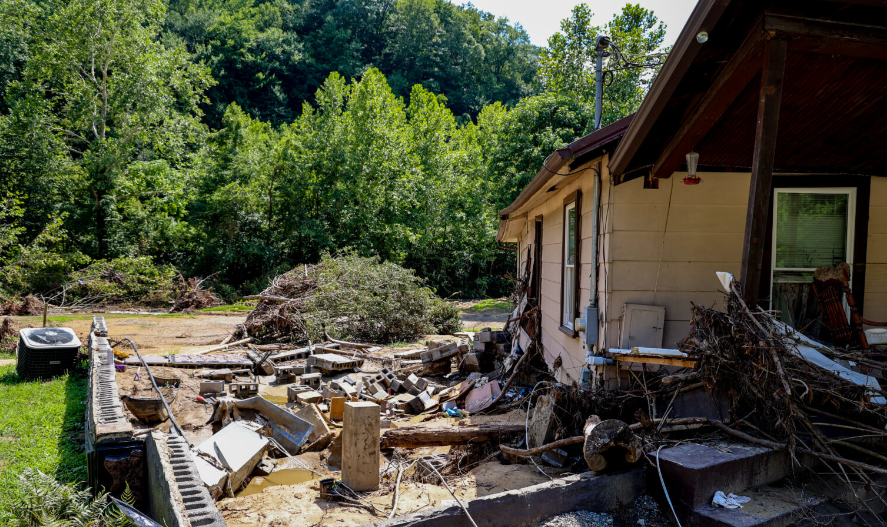
A home in Pilgrim’s Knob, Virginia, sits empty after being lifted from its foundation by a recent flood. Credit: Chris Kenning, USA Today.
By Chris Kenning, Connor Giffin and James Bruggers, Inside Climate New
Devastating floods that killed at least 37 people in Kentucky and recent damage in other parts of Appalachia, including Virginia and West Virginia, are fueling urgent questions about how to mitigate the impact of hazardous flooding that is only expected to increase as climate change fuels more extreme weather.
But in one of America’s most economically depressed regions, there are few easy answers.
The region’s mountainous landscape, high poverty rates, dispersed housing in remote valleys, coal-mining scarred mountains that accelerate floods and under-resourced local governments all make solutions extremely difficult.
Measures such as flood wells, drainage systems or raising homes are expensive for cash-strapped counties. Buyouts or building restrictions are difficult in areas where safer options and new home construction are limited. Many are unable or unwilling to uproot.
And tamping down extreme weather by reducing climate-changing emissions nationwide is a goal that is politically fraught, including in a region with coal in its veins, that promises no quick relief.
“If we had all the money in the world, and we had the political will and cooperation, we could go a long way towards solving these problems,” said William Haneberg, director of the Kentucky Geological Survey and a professor of Earth & Environmental Sciences at the University of Kentucky.
If you liked this post you’ll love our daily environmental newsletter, EnviroPolitics.It’s packed with the latest news, commentary, and legislative updates from New Jersey, Pennsylvania, New York, Delaware…and beyond. Don’t take our word for it, try it free for an entire month. No obligation.
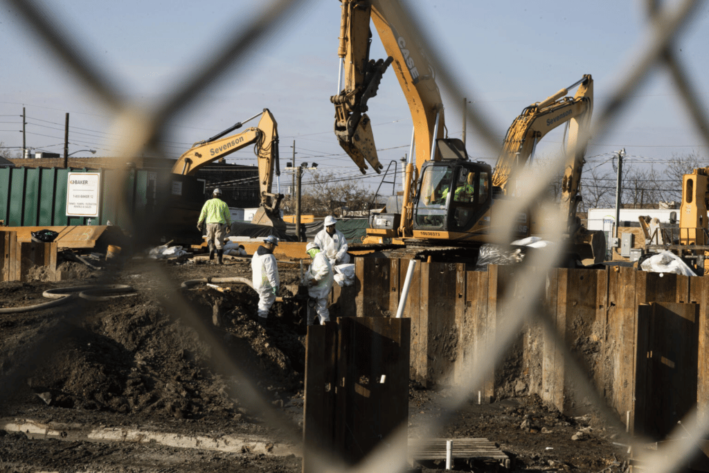
File photo: Men in protective clothing work at a Superfund site in Camden.
By Jon Hurdle, NJ Spotlight
New Jersey filed its latest lawsuit seeking compensation for alleged damages to the environment, this time claiming that Monsanto and two former affiliates produced toxic PCBs that leaked into the state’s air and water over almost 50 years.
The lawsuit says the companies caused “significant, long-term damage” to the state’s waterways and groundwater, as well as to soil, air, and wildlife by allowing and encouraging disposal of the chemicals that they knew to be hazardous at Monsanto’s plant beside the Delaware River in Bridgeport, Gloucester County.
The companies advised their customers to dispose of PCB waste directly into sewers and to vent the chemical vapors into the atmosphere despite knowing that the actions would cause environmental contamination and expose residents to substances that are linked to health complaints, including liver damage, respiratory infections, and some cancers, the suit said.
“PCB contamination has harmed natural resources and threatened the health of humans and wildlife in every corner of New Jersey, from remote rural areas to suburban neighborhoods, to our cities,” said acting Attorney General Matthew Platkin, in a statement last week.
First of its kind
It’s the state’s first suit alleging that PCBs damaged the natural environment.
The Murphy administration has now filed 19 “natural resource damage” lawsuits against industrial polluters, alleging long-term damage to the environment and public health and seeking a court order for the companies to pay for the investigation and cleanup. None of the lawsuits has so far been resolved, according to the attorney general’s office.
In 2019, the state sued Sherwin-Williams claiming it discharged waste products from manufacturing paints, lacquers, and varnishes into a Camden County creek. Contamination at this location, along with lead and arsenic, also led the U.S. Environmental Protection Agency to designate it a Federal Superfund site in 2008. It became one of New Jersey’s 114 Superfund sites, the most of any state.
Also in 2019, the state sued Handy & Harman Electronic Materials Corp. for allegedly discharging hazardous materials including TCE (trichloroethylene), a degreasing chemical, into groundwater near its factory in Bergen County in the 1980s.
Tougher than Christie
Overall, the actions signal that the Murphy administration is taking a more aggressive stance against corporate polluters than its predecessor, the Christie administration, which filed no such suits.
Jeff Tittel, former director of the New Jersey Sierra Club, welcomed this latest lawsuit but said the state would have a better chance of winning such legal challenges if the state Department of Environmental Protection had a regulatory framework that addressed corporate responsibility for damage to natural resources.
“The DEP has never developed rules and standards for natural resource damages,” he said. “Not having clear standards in place hinders our ability to prosecute these cases to the extent that we need to.” The absence of such regulations also limits the amount of money that the state can seek in damages and makes settlements more likely, he said.
“The AG is taking the right approach by suing; the DEP has a lot of work to do to move these things along,” Tittel said.
That criticism was echoed by the Chemistry Council of New Jersey, which said the DEP has failed to comply with a 2004 agreement between the attorney general’s office and plaintiffs, including the council, to develop regulations on natural resource damages and to stop filing those cases until such regulations are published.
If you liked this post you’ll love our daily environmental newsletter, EnviroPolitics.It’s packed with the latest news, commentary, and legislative updates from New Jersey, Pennsylvania, New York, Delaware…and beyond. Don’t take our word for it, try it free for an entire month. No obligation.
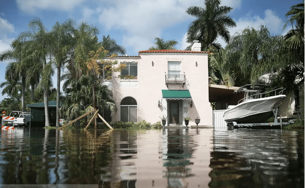
Nearly one trillion dollars of US real estate is threatened by rising seas, and the risk is already affecting home values
Nearly one trillion dollars of US real estate is threatened by rising seas, and the risk is already affecting home values — Business Insider
By Frank Brill, EnviroPolitics Editor
It’s inescapable: Global warming is real. It is triggering unprecedented droughts and raging forest fires in the west, punishing floods in farm states, and rising ocean levels along our east coast.
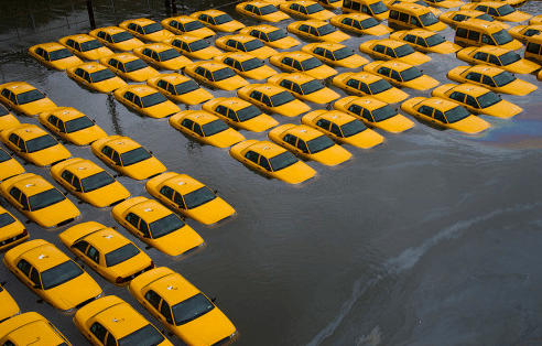
Taxi parking lot in Hoboken, NJ hit by Superstorm Sandy
Global warming cannot be denied, except by political idealogues, conspiracy theory spreaders, and self-serving fossil-fuel corporations. It’s getting worse by the day and the projected costs to deal with it are staggering.
Mike Italiano helped create the U.S. Green Building Council and its LEED building standards that are rewarding forward-looking companies with higher building occupancy and lower operating costs
Mike Italiano, CEO, Capital Markets Partnership
We will sit down with Mike next week for a video interview to learn about his team’s funding plan–one, he says, that would not involve tax-payer contributions.
Too good to be true? We recommend that you watch the interview, take notes, and submit your follow-up questions for Mike’s response.
If you liked this post you’ll love our daily environmental newsletter, EnviroPolitics.It’s packed with the latest news, commentary, and legislative updates from New Jersey, Pennsylvania, New York, Delaware…and beyond. Don’t take our word for it, try it free for an entire month. No obligation.
The Senate and Assembly environmental committees will meet jointly in Toms River next Thursday on bills to prohibit state pension fund investments in the nation’s largest 200 fossil fuel companies.
If you liked this post you’ll love our daily environmental newsletter, EnviroPolitics.It’s packed with the latest news, commentary, and legislative updates from New Jersey, Pennsylvania, New York, Delaware…and beyond. Don’t take our word for it, try it free for an entire month. No obligation.
But utilities say they need additional supply to meet growing customer demand
By Tom Johnson, NJ Spotlight
In a rare alliance, the New Jersey Board of Public Utilities and the state Division of Rate Counsel are jointly fighting the expansion of an interstate natural gas pipeline by arguing consumers should not have to pay for the unneeded gas capacity that would be provided by the project.
In a filing with the Federal Energy Regulatory Commission, the two state agencies contend that a study adopted by the BPU earlier this summer found that New Jersey is unlikely to experience shortages in natural gas through the end of this decade.
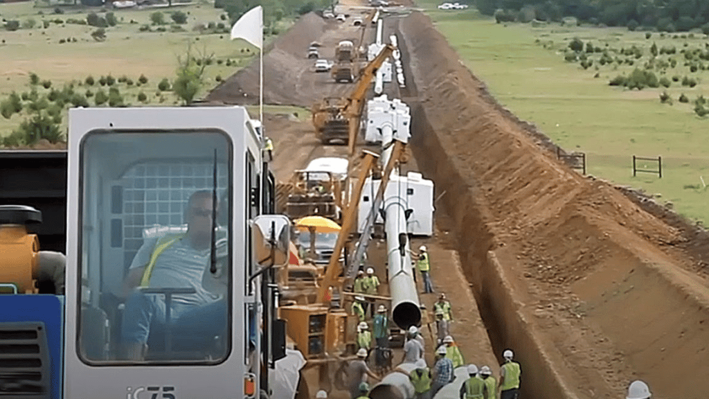
That conclusion is contested by the state’s four gas utilities, all of which have agreed to purchase additional gas capacity for the 2024 winter heating season. Transcontinental Gas Pipeline Company (Transco) designed this project to increase the capacity of its existing pipeline system by 829,000 dekatherms per day in Pennsylvania, New Jersey, and Maryland.
Feuding over fossil fuel
The dispute is meaningful because it comes at a time when climate advocates have been pressing the Murphy administration to impose a moratorium on new fossil-fuel projects, a stance so far rejected by officials.
“This is a historic moment for the BPU and Rate Counsel to acknowledge the obvious. We do not need more fracked gas in New Jersey,’’ said Doug O’Malley, director of Environment New Jersey.
“What’s significant is the BPU is taking a step toward looking at the broader issues and whether this project is needed,’’ said Tom Gilbert, an executive director of the New Jersey Conservation Foundation. “It is a huge change in their operating procedures.’’
In the past, Gilbert’s organization and the Rate Counsel had opposed a controversial 120-mile pipeline in New Jersey and Pennsylvania that would have crossed waterways and open spaces on this side of the Delaware River. The New Jersey portion of the so-called PennEast project was eventually dropped because of repeated delays.
If you liked this post you’ll love our daily environmental newsletter, EnviroPolitics. It’s packed with the latest news, commentary, and legislative updates from New Jersey, Pennsylvania, New York, Delaware…and beyond. Don’t take our word for it, try it free for an entire month. No obligation.
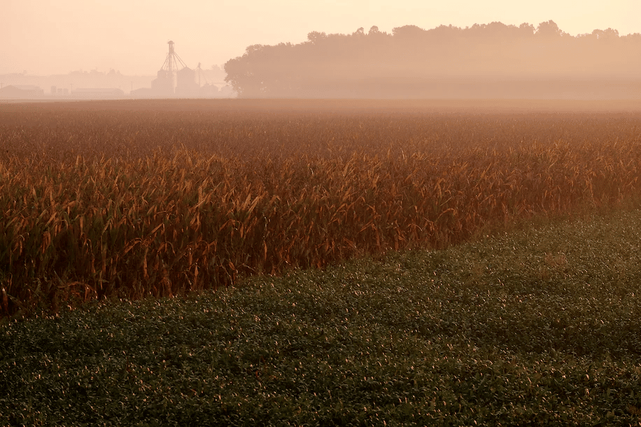
Fog lingers on fields of corn and soybean in the community of Lyles Station in Princeton, Ind., in 2016. (Bonnie Jo Mount/The Washington Post)
By Barb Mayes Bousteads, Washington Post
During summer, the Midwest can experience some of the most oppressive humidity in the country. Fields in Iowa can be muggier than beaches in Miami. The culprit? Billions of stalks of corn.
Akin to a person breathing, plants exhale water into the atmosphere through a process called evapotranspiration. Some call it “corn sweat.”
In the Midwest and northern Plains, corn and soybean crops draw moisture from the ground through their roots into their leaves, stems, and fruits. The water evaporates into the surrounding air through their leaves, joining forces with neighboring water molecules to humidify the air.
Densely planted across millions of acres, corn can bring a-maizing levels of humidity during the middle of summer. One acre of corn can release 4,000 gallons of water per day, enough to fill a residential swimming pool in less than a week.
If you liked this post you’ll love our daily environmental newsletter, EnviroPolitics.It’s packed with the latest news, commentary, and legislative updates from New Jersey, Pennsylvania, New York, Delaware…and beyond. Don’t take our word for it, try it free for an entire month. No obligation.